![]()
![]()
![]()
Deepwater Rice - towards a general understanding - 2 - a riverine country |
What is it about Bangladesh that makes it so nearly unique? Nearly unique because similarities of geography exist in the Indian states of West Bengal and Assam, in central Thailand, in the Mekong area of Vietnam and some other areas.
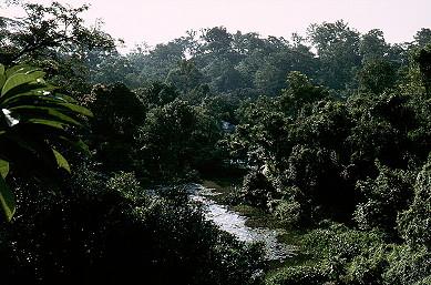
What all these have in common is that they are areas dominated by major rivers. Moreover, these rivers annually rise greatly and dramatically due to a combination of the heavy monsoon rains and snowmelt in vast watersheds.
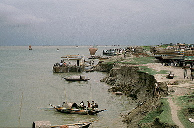
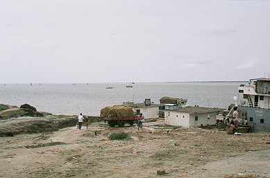
To convey the scale and influence of the rivers, Nagarbari on the left is the ferry station on the western bank of the Brahmaputra or Jamuna above the confluence with Ganges or Padma. On the right is a ferry station, Kurmakalighat, for the crossing of the Chitla River, a mere distributary of the Ganges in Faridpur District.
 |  |
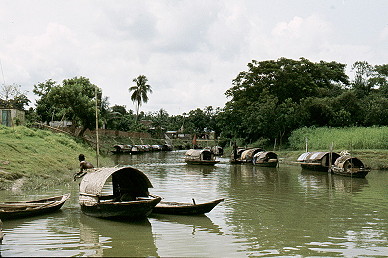
and transport by water is normal - on the left is the Meghna river at Daudkandi and on the right is the market "car-park" at Matlab Bazaar.
 |  |
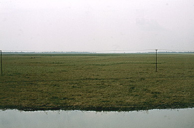
Perhaps even more dramatically, the left-hand photo below shows the lay of the land characteristic of so much of the Bangladesh. Here near Natore in Pabna District is among the largest of the natural saucer-shaped depressions, locally known as a beel (or hoar, that I saw. The right-hand photo shows from a distance the ancient Buddhist monastery of Parharpur, near Bogra. Translated Parharpur means "place of the hill" so perhaps you are getting the idea.
 |  |
Parharpur is shown at close range below (left) and this man-made hill is the highest point for miles around (at 22 m, 72 feet in height). There are real hills in Bangladesh, such as those on the right, but only in the western extremes, in the Chittagong Hill Tracts and here in Sylhet.
 |  |
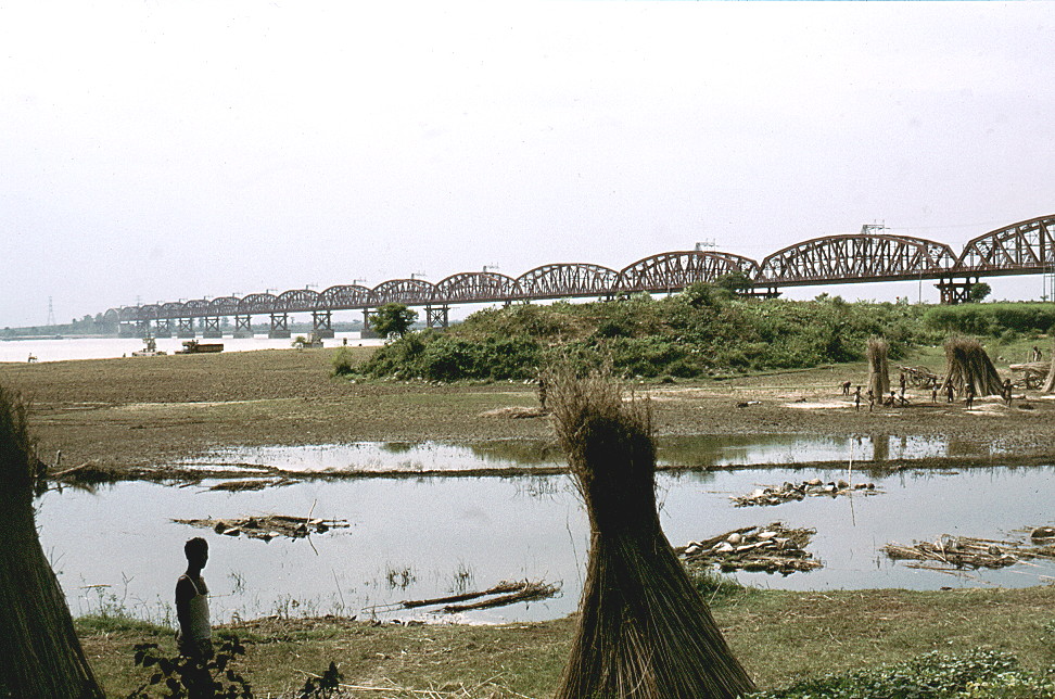
If you still do not believe look at this - the last and only bridge over the Ganges in Bangladesh, and just inside the western border - the Hardinge Bridge. Here the water level in the river varies from a dry season depth of under 6 m to well over 15 m in the late monsoon season. The bridge itself was opened in 1915 (1917) and is about a mile long, with 15 girder spans each of 345 feet (105 m) and three land spans of 75 feet (23 m) at either end (total 1715 m). somewhat ironically it serves little purpose to Bangladesh, having been built as a link from Calcutta to Assam. A small number of trains still make that journey - starting and finishing in India. An interesting insight into the history can be found at "Mike's Railway History" site.
 |
So now perhaps we do understand a little of the geography - mostly flat, flat and more flat land and we can go on to learn of the the deepwater rice crop and the farming year - - - - -
![]() what is deepwater rice?
what is deepwater rice?
| ©2000 - Brian Taylor CBiol FIBiol
FRES 11, Grazingfield, Wilford, Nottingham, NG11 7FN, U.K. Visiting Academic in the Department of Life Science, University of Nottingham |
href="\dwr\general2.htm"